

Southern California residents should prepare for a wet and active few days as a sequence of weather systems moves into the region. According to the National Weather Service, two Pacific storms are arriving late Thursday evening, bringing rain that is scheduled to start after midnight specifically in Los Angeles County. As the system moves through, forecasters anticipate that scattered showers will be prominent across the area Friday morning.
In addition to standard rainfall, forecasters have warned of a potential for thunderstorms developing late Thursday and Friday. For the most part, precipitation rates are expected to stay at or under a quarter-inch hourly typically. However, forecasters also noted there is a twenty to thirty percent chance of localized half-inch hourly rates occurring during more intense periods. Addressing the approaching system, the National Weather Service told a local news report, "Our next weather system is rapidly approaching,".
The incoming weather will also bring a noticeable shift in daily temperatures across the region. Forecasters stated that Thursday high temperatures will drop five to ten degrees from Wednesday readings. Looking toward the weekend, forecasters expect Friday and Saturday highs to hit the sixties to low seventies.
The active weather pattern will continue as forecasters track a second frontal rain round arriving late Friday afternoon into Saturday. Overall, forecasters estimate that storm totals will span a quarter-inch to one inch generally across the affected areas.
The broader weather pattern shows no immediate signs of stopping after the weekend clears. The National Weather Service highlighted subsequent storms hitting Sunday night through Tuesday and Wednesday. Expanding on this outlook, the National Weather Service told a local news report, "Pattern-wise, the `storm train’ is expected to continue with one storm impacting the area Sunday night through Tuesday then another system during the day on Wednesday/Wednesday night,".
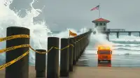
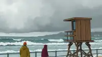
Along the coast, significant ocean activity is on the way alongside the rain. A Beach Hazards Statement is currently active for Malibu and Los Angeles beaches, remaining in place until Friday afternoon. Immediately following that alert, a High Surf Advisory will run from two p.m. Friday until three p.m. Tuesday. Coastal visitors can expect breaking waves reaching four to seven feet on Friday. Surf conditions will then intensify further, climbing to seven to twelve feet on Saturday. Hazardous conditions will gradually ease as waves drop to six to nine feet from Sunday through Tuesday.